

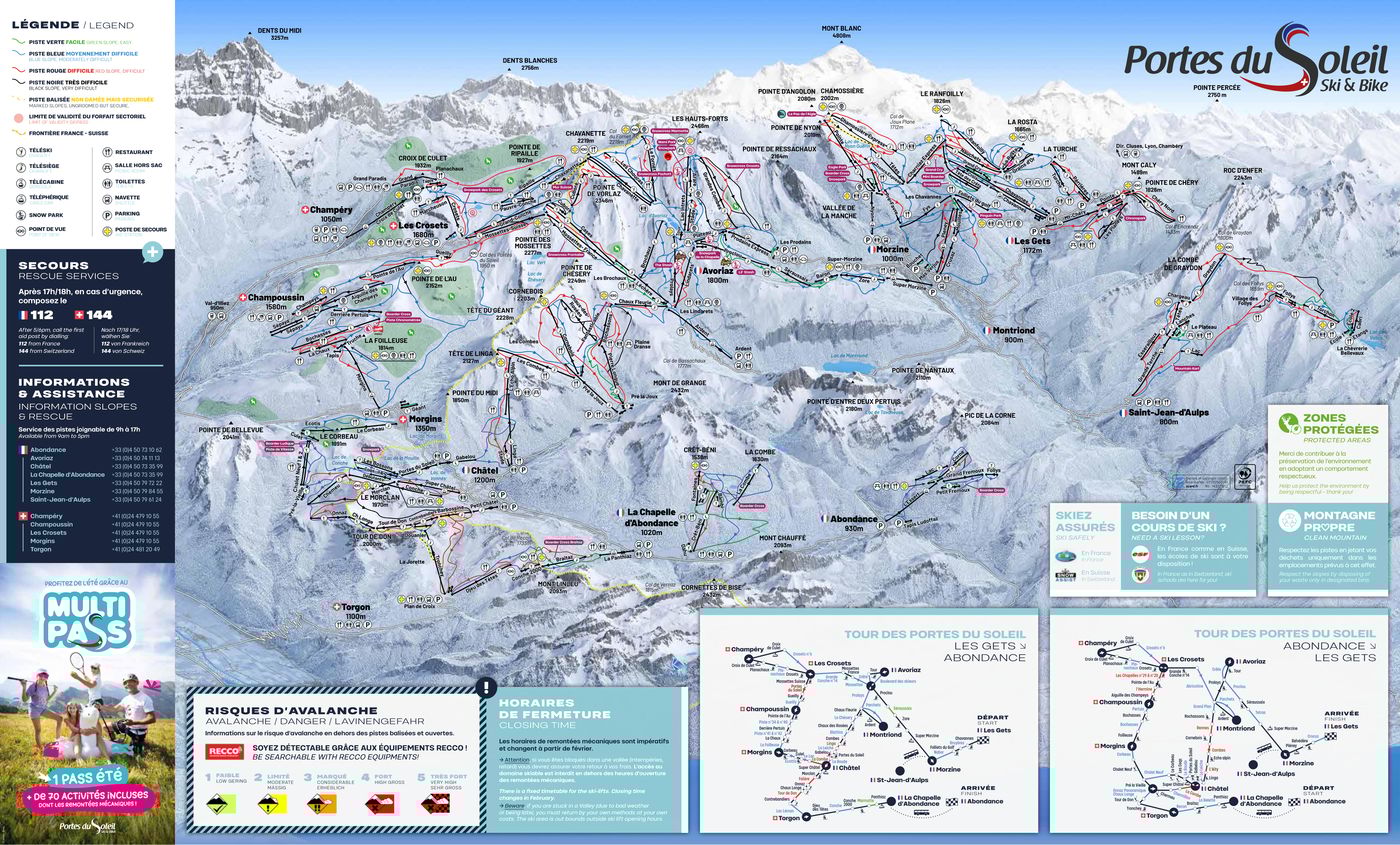
Champéry Piste Map
Grab the Champéry ski resort map to explore this charming Swiss village that connects into the massive Portes du Soleil, one of the world's largest lift-linked ski areas. The trail map reveals 21 runs served by 17 lifts across a vertical drop from 2,277m down to 1,040m, with the terrain split between 11 beginner, 7 intermediate, and 3 advanced pistes. Champéry's groomed runs score an impressive 4.64 out of 5 from our community, whilst lift efficiency rates equally high at 4.82, making it a solid choice for cruisy days exploring this corner of the Swiss Alps.
Download the Champéry Piste Map (PDF & Image)
Best Runs in Champéry
-
Ripaille (Blue): A long, sweeping cruise from Swiss Wall that takes you all the way down to the village with consistent gradient throughout.
-
Grand Conche (Red): A wide, confidence-building intermediate run that's ideal for practising carved turns on well-groomed snow.
-
Culet (Red): A tree-lined descent offering shelter on stormy days and consistent pitch perfect for progression.
-
Planachaux (Blue): A gentle, sun-soaked cruiser above the village that's popular with ski schools and great for building mileage.
-
Chavanette - Swiss Wall (Black): One of the steepest mogul fields in the Alps, dropping straight down the border with relentless bumps and serious bragging rights.
-
Grand Paradis (Black): A properly challenging steep pitch accessed from Pointe de l'Au that demands commitment and solid technique.
-
Croix de Culet (Red): A fantastic top-to-bottom run with varied terrain that links multiple sections and keeps you engaged all the way down.
-
Combe de l'Au (Blue): A scenic traverse and gentle descent offering stunning views across to the Dents du Midi while you warm up your legs.