

Itter - SkiWelt Piste Map
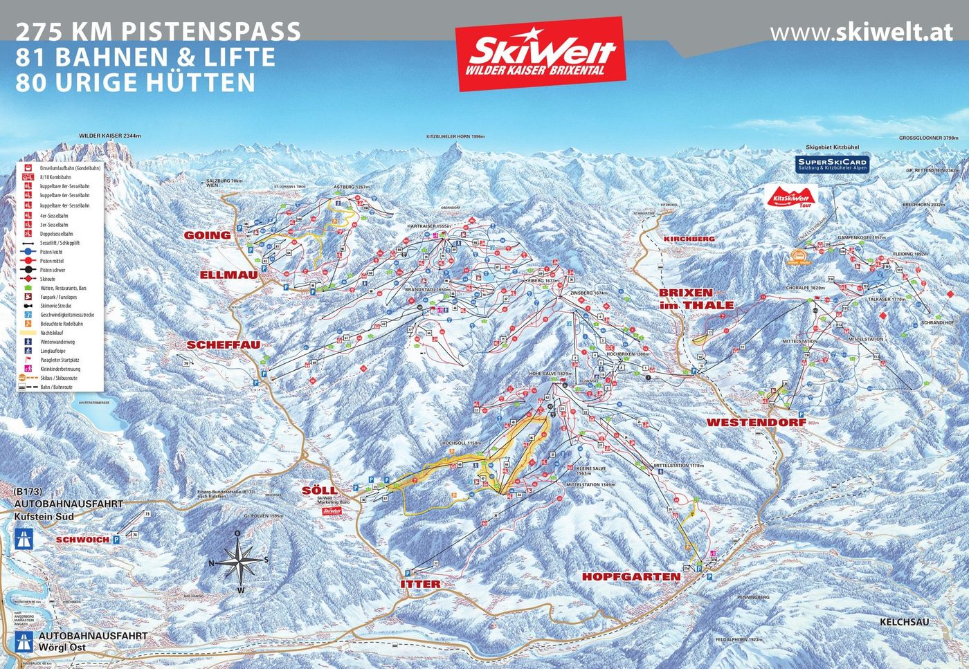
Grab the ski resort map for Itter - SkiWelt to see what's on offer across this brilliant Austrian resort. The trail map reveals access to 225 runs spread across the wider SkiWelt area, with 116 beginner trails, 80 intermediate runs, and 29 advanced pistes serviced by 82 lifts in total. Riding between 620m and 1869m, you'll find plenty of variety whether you're cruising groomers or lapping the terrain parks.
Download the Itter - SkiWelt Piste Map (PDF & Image)
Best Runs in Itter - SkiWelt
Itter is a small village linked into the SkiWelt, so while it's got its own local slopes, you're mainly accessing the broader SkiWelt circuit. Here's what you'll find descending back to Itter and in the immediate area:
-
Familienabfahrt Itter (Blue): A wide, gentle cruiser that runs from Hochetzkogel down to the village, ideal for building confidence on your first proper mountain descents.
-
Piste 1 Salvenberg (Blue): A long, sweeping run from the mid-station that's perfect for early intermediates looking to practise flowing turns without any nasty surprises.
-
Piste 2 Salvenberg (Blue): Runs parallel to Piste 1 with similarly mellow terrain, giving you options when one gets tracked out or busier with ski schools.
-
Piste 4 (Red): A more direct route down to Itter with a bit more pitch, offering intermediates a chance to pick up speed and work on their carving technique.
-
Piste 3 (Red): Links across from Hochetzkogel with decent width and a consistent gradient that's brilliant for laying down clean arcs when the grooming's fresh.
-
Hochetzkogel to Salvenberg Connector (Red): A useful linking run that maintains a good rhythm and lets you explore different parts of the local area without dropping all the way back to the valley.