

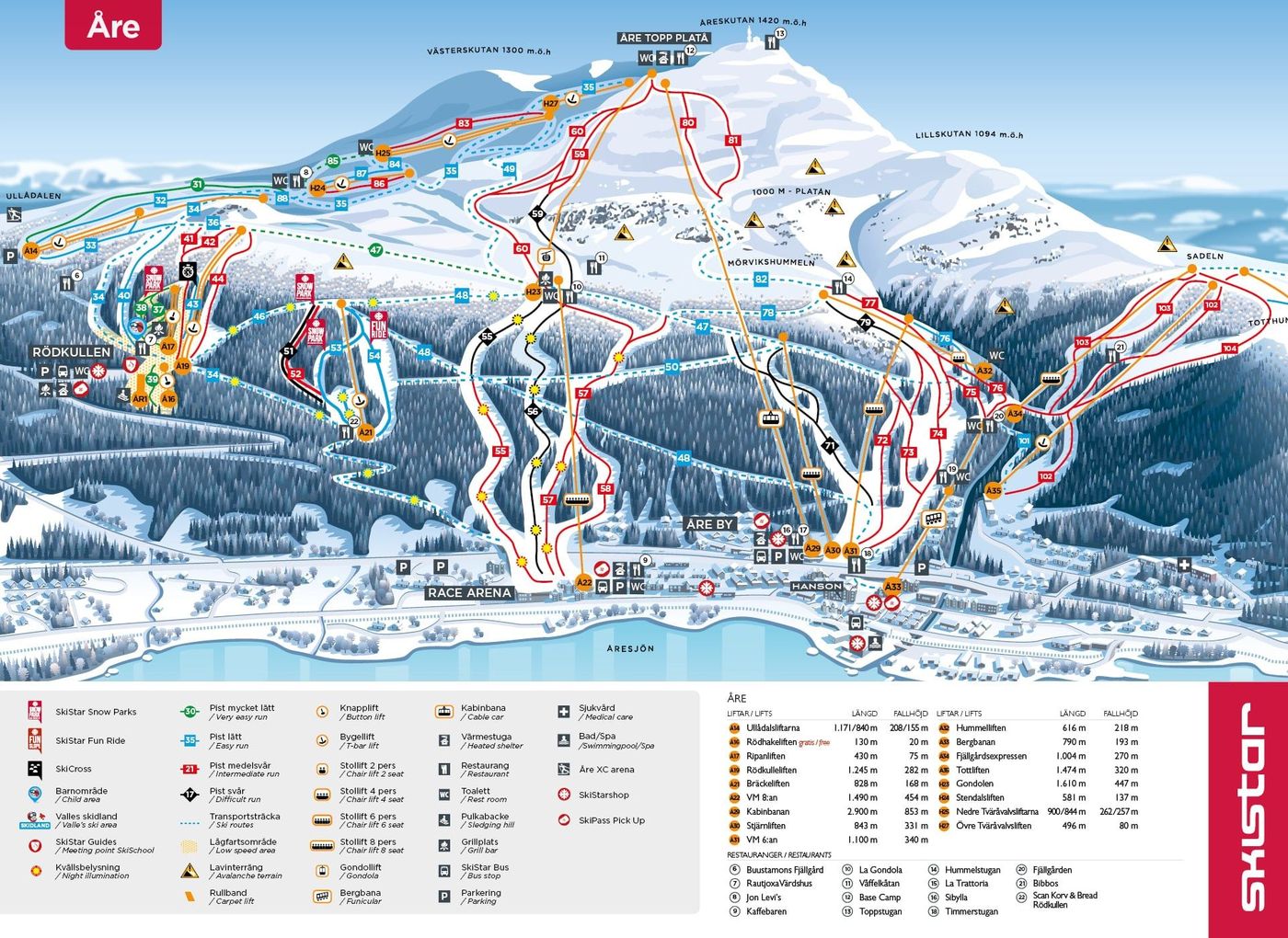
Åre Piste Map
Grab the official Åre ski resort map to get familiar with one of Scandinavia's largest winter playgrounds before you arrive. The trail map covers 80 runs across nearly 900 vertical metres, from 384m up to 1274m, with a solid mix of 16 beginner, 31 intermediate and 29 advanced runs. You'll also find 46 lifts including three gondolas and eight chairlifts linking the various sectors across the mountain.
Download the Åre Piste Map (PDF & Image)
Best Runs in Åre
-
Tottbacken (Green): A wide, gentle slope in the Björnen area ideal for complete beginners taking their first turns.
-
Blå Bandet (Blue): A long, cruisey blue run stretching from VM8 down to the village with consistent pitch and excellent grooming for building confidence.
-
Fjällgården (Blue): A scenic tree-lined intermediate run offering sheltered skiing and smooth carving terrain when conditions get windy higher up.
-
Stockholmsbacken (Red): A proper red with consistent steep pitches and decent width, perfect for intermediates looking to push their carved turns.
-
VM-backen (Red/Black): The famous World Championship downhill course offering serious vertical and sustained steepness that'll test your legs and technique.
-
Backsidan (Black): A steep, mogul-filled black run on the backside of Åreskutan that demands precise line choice and strong legs.
-
Gäddsågen (Black): A challenging black diamond with technical terrain and often variable snow conditions that rewards aggressive skiing.
-
Slalombacken (Black): A steep, direct fall-line run that's regularly used for racing, featuring relentless gradient and excellent snow preservation.