



Combloux Piste Map
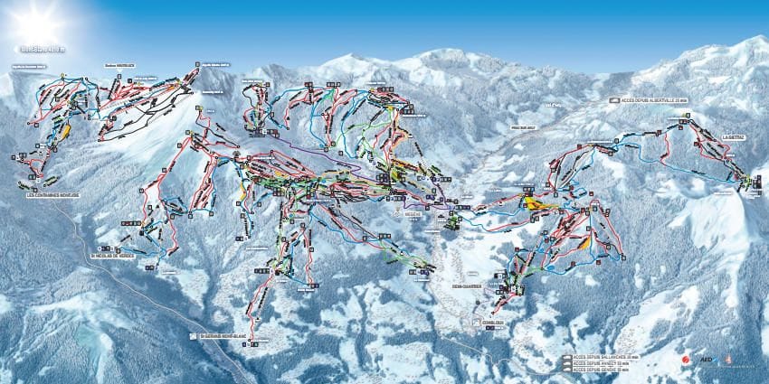
Grab the Combloux ski resort map to get your bearings before you hit the slopes - it's worth downloading so you can navigate the 65 runs without faff. The trail map covers terrain from 1183m up to 1930m, with 11 beginner runs, 17 intermediate pistes, and 29 advanced runs serviced by 1 gondola, 8 chairlifts, and 20 drag lifts. Combloux also links into the wider Portes du Mont-Blanc area, giving you access to even more terrain across the valley.
Download the Combloux Piste Map (PDF & Image)
Best Runs in Combloux
-
Piste de la Cry (Green): A wide, rolling cruiser that winds gently through the forest, ideal for building confidence with plenty of space to practise turns.
-
Bouchet (Blue): A mellow tree-lined run offering lovely views across to Mont Blanc, perfect for intermediates looking to clock up mileage in a relaxed setting.
-
Plan du Lait (Blue): A long, sweeping piste that connects the upper slopes down to the village with consistent pitch and good grooming for easy cruising.
-
Tetras (Blue): A scenic mid-mountain run that opens up panoramic views over the Arve Valley whilst maintaining a friendly gradient throughout.
-
Pertuis (Red): A steeper, more technical descent with some tighter turns and varied terrain that'll test your edge control without being overly intimidating.
-
Le Mur (Red): The name gives it away—this short, sharp pitch delivers a punchy challenge with a sustained steep section that gets the thighs burning.
Airport transfers with Alps2Alps
Save 5% with code SNOMADSKI, or Snomad members can save up to 12%.