

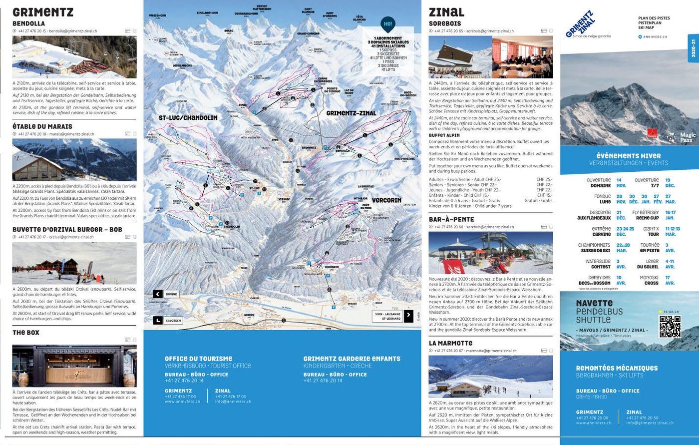
Vercorin Piste Map
Grab the Vercorin ski resort map below to get familiar with the layout before you head out. The trail map covers 11 runs split across 3 beginner, 6 intermediate, and 2 advanced pistes, with a vertical drop from 2336m down to 1330m. You'll find 2 gondolas, 1 chairlift, and 6 drag lifts serving the terrain, making it easy to navigate this compact Swiss resort.
Download the Vercorin Piste Map (PDF & Image)
Best Runs in Vercorin
-
Piste du Lac (Blue): A long, confidence-building cruise from mid-mountain to the village with wide turns and consistent gradient ideal for intermediates.
-
Piste de Crêt-du-Midi (Blue): This scenic run from the highest point offers sweeping views across the valley and smooth, well-groomed terrain for carving.
-
Piste de Barmaz (Red): A proper thigh-burner dropping through open terrain with steeper pitches that'll test your technique on the way down.
-
Piste de Tsarmetta (Red): A challenging descent with varied terrain including narrower sections and steeper gradients that keeps you engaged throughout.
-
Piste de Tsalè (Blue): A mellow, tree-lined cruise that's perfect for building mileage and enjoying the forested setting without too much drama.
-
Tsalè Slalom (Red): A more technical variant that cuts through the trees with quick direction changes and steeper sections for those wanting a bit more bite.