

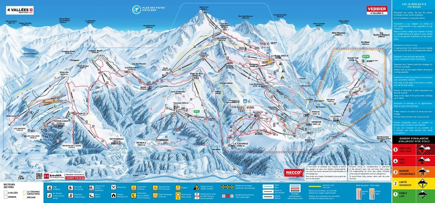
Bruson et Val de Bagnes Piste Map
Grab the ski resort map for Bruson et Val de Bagnes to plan your day on the mountain. The trail map covers six runs spanning from 2220m down to 821m, including one beginner piste, four intermediates, and one advanced run. You'll find one gondola, two chairlifts, and a drag lift servicing the terrain.
Download the Bruson et Val de Bagnes Piste Map (PDF & Image)
Best Runs in Bruson et Val de Bagnes
-
Piste de l'Ours (Blue): A long, rolling cruiser that descends through open terrain with consistent pitch, ideal for building confidence and rhythm.
-
Les Etablons (Red): A varied intermediate run offering sweeping turns and stunning views across the valley, perfect for progressing skiers looking to carve.
-
La Pasay (Blue): Wide and forgiving with gentle gradients, this run is a favourite among ski schools and families seeking mellow progression terrain.
-
Les Tsarronnes (Red): A steeper, more technical red that challenges intermediates with tighter turns and variable terrain underfoot.
-
Piste du Larzey (Black): A proper test piece with sustained steepness and mogul fields that form quickly, demanding solid technique and leg strength.
-
Les Fontaines (Blue): A scenic blue winding through open alpine pastures, offering relaxed skiing with beautiful panoramas toward the main Verbier valley.
-
La Combe (Red): A broad red run with excellent snow retention thanks to its north-facing aspect, great for confident intermediates seeking consistent fall-line skiing.