

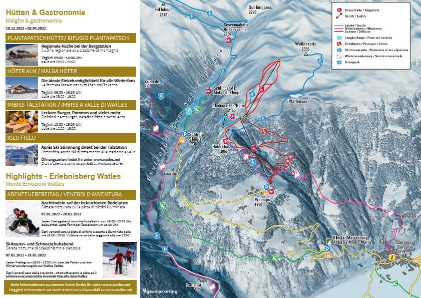
Watles Piste Map
Grab the Watles ski resort map to plan your day on this compact Italian spot. The trail map covers six runs split evenly between beginner, intermediate and advanced terrain, serviced by two chairlifts and a drag lift. With a top elevation of 2500m and a base at 1750m, you've got 750 vertical metres to explore across this quiet South Tyrolean gem.
Download the Watles Piste Map (PDF & Image)
Best Runs in Watles
-
Kirchebahn (Blue): A gentle, wide cruiser that's ideal for building confidence and practising turns without the crowds.
-
Talabfahrt (Blue): The main valley descent offering a long, sweeping run back to the base with consistent gradient and excellent grooming.
-
Sesselbahn (Red): A varied intermediate trail with enough pitch to keep things interesting while remaining forgiving for progressing skiers.
-
Watles (Red): The signature run of the resort, stretching from summit to valley with beautiful open terrain and reliable snow coverage.
-
Schöneben (Red): A carving paradise with consistent pitch and well-maintained pistes that suit confident intermediates looking to lay down some arcs.
-
Nordabfahrt (Red): A north-facing descent that holds snow quality brilliantly throughout the season, offering excellent grip and consistent conditions.