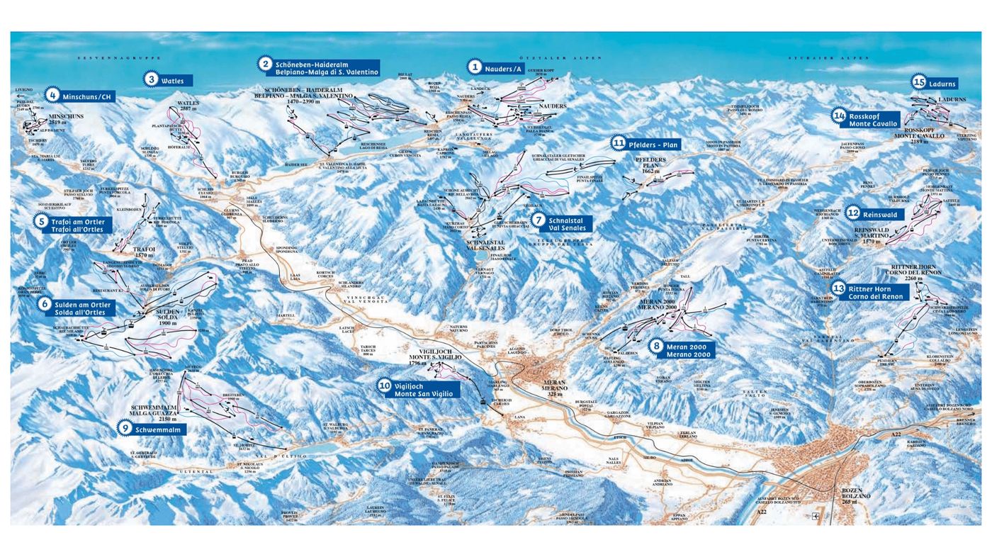


Belpiano Piste Map
Grab the Belpiano ski resort map to get familiar with this compact Italian resort, which sits at the southern end of the Ortler Ski Arena—one of South Tyrol's largest linked areas. The trail map covers 12 runs split between 2 beginner, 6 intermediate, and 4 advanced pistes, all served by 3 gondolas or cable cars, 4 chairlifts, and 2 drag lifts. Terrain runs from 1,460m up to 2,390m, offering a decent vertical spread for cruising and progression.
Download the Belpiano Piste Map (Image)