

La Clusaz Piste Map
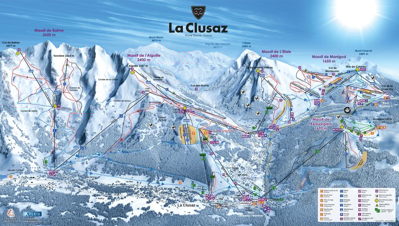
Grab the La Clusaz ski resort map to get your bearings before you head out - it's well worth downloading to your phone. The trail map covers 84 runs spread across five different mountains, with terrain split between 16 beginner runs, 30 intermediate runs, and 30 advanced runs, all accessed by 54 lifts including five gondolas. The ski area spans from 1,040m up to 2,500m, offering varied terrain across the Aravis mountain range.
Download the La Clusaz Piste Map (PDF & Image)
Best Runs in La Clusaz
La Clusaz dishes up proper variety across its five distinct valleys, and you'll find runs to match whatever mood you're in. Here's what stands out on the mountain:
-
Champ Giguet (Green): A wide, forgiving green run from the Crêt du Merle area that's ideal for building confidence on your first days.
-
Merdassier (Blue): This long cruiser winds down from L'Aiguille through the trees, offering a scenic descent back towards Beauregard.
-
LesRiffroids (Blue): A popular blue running down the Beauregard sector with consistent pitch and good width for practising parallel turns.
-
Fernuy (Red): A properly fun red that drops down through the Balme valley with steep sections and excellent snow retention thanks to its north-facing aspect.
-
Combe du Fernuy (Red): This red variant offers a steeper, more direct line down the same valley with some decent fall-line skiing.
-
L'Étale (Red): A challenging red that demands respect, featuring sustained gradient and often developing moguls on busier days.
-
La Combe de Borderan (Black): La Clusaz's signature steep run, this black drops down a genuine couloir with a narrow top section that'll get your heart rate up.
-
Lac des Confins (Black): A technical black run on the L'Aiguille side that's frequently left to bump up, rewarding skiers who can handle variable terrain.