



Willamette Pass Trail Map
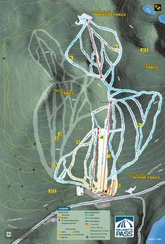
Check out the Willamette Pass ski resort map above to get a full overview of the terrain before you visit. The trail map covers 29 runs spread across 476 metres of vertical, with the slopes reaching from 1,561m at the base to 2,037m at the top. You'll find 6 beginner runs, 13 intermediate trails and 3 advanced runs, all accessed by a single chairlift.
Download the Willamette Pass Trail Map (Image)
Best Runs in Willamette Pass
-
Twilight (Green): A mellow, wide cruiser that winds gently through the trees, ideal for building confidence on your first day out.
-
Eagle Peak (Blue): A scenic intermediate run offering consistent pitch and flowing turns with forested sections and open glades.
-
Broadway (Blue): A long, confidence-building cruise that's perfect for intermediates looking to rack up vertical without technical nasties.
-
East Broadway (Blue): A tree-lined alternative to Broadway with a bit more character and slightly tighter turns through the forest.
-
Meadows (Blue): A wide-open intermediate run that's great for practising carved turns when the groomers have done their magic.
-
Dutchman Flat (Blue): A rolling intermediate trail that meanders through gladed terrain, offering a fun mix of pitch changes.
-
West Broadway (Black): A properly steep descent that'll get your thighs burning, with consistent fall-line skiing through tighter trees.
-
Face (Black): The resort's signature steep run delivering relentless pitch and a proper workout for confident skiers.
-
Ditch (Black): A narrow, technical line that demands precise turns and rewards aggressive skiing through tight terrain.