

Chapelco Piste Map
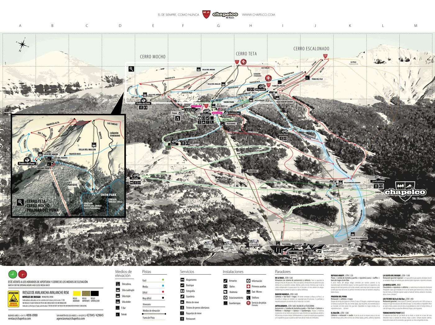
Check out the Chapelco ski resort map above to get your bearings before you hit the slopes. The trail map covers 28 runs spread across a vertical drop from 2,101m to 1,946m, serviced by 12 lifts including a gondola, six chairlifts and five drag lifts. It's a self-contained resort rather than part of a larger ski area, offering a solid mix of terrain in the Argentine Andes.
Download the Chapelco Piste Map (PDF & Image)
Best Runs in Chapelco
-
Graeff (Green): A wide, gently sloping run ideal for first-timers building confidence on skis.
-
Bosque Llao Llao (Blue): A scenic intermediate cruise winding through native lenga forests with consistent pitch throughout.
-
Tobogán (Blue): A broad, well-groomed piste offering excellent carving terrain for progressing intermediates.
-
Amistad (Blue): A long cruiser connecting different sectors of the mountain with mellow gradients and sweeping turns.
-
Amancay (Red): A steep, sustained descent demanding solid technique and leg strength from experienced skiers.
-
Tucu Tucu (Red): A technical run featuring mogul fields and narrow sections that challenge advanced riders.
-
Graeff Directo (Red): A direct fall-line route down the mountain with challenging steeps and ungroomed sections.
-
La Hoya (Black): The steepest marked run on the mountain, offering genuine black-level pitch and exposure for experts.