

Cerler Piste Map
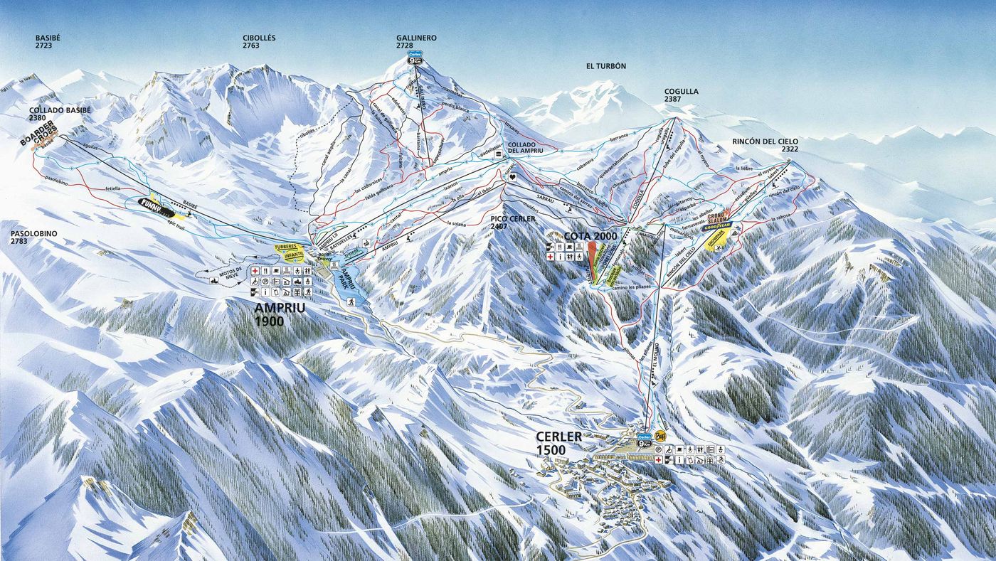
Grab the Cerler ski resort map below to get the lay of the land before you arrive - it's a handy way to scope out where you'll be spending your days on the mountain. The trail map covers 73 runs spread across 1,130 metres of vertical from 2,630m down to 1,500m, with a good mix of 12 beginner, 18 intermediate and 27 advanced pistes. You'll find 10 chairlifts and 10 drag lifts keeping things moving across the terrain.
Download the Cerler Piste Map (PDF & Image)
Best Runs in Cerler
-
Basibé (Green): A wide, gentle slope at the base area ideal for first-time skiers building confidence.
-
Rincón de Gallinero (Blue): A long, cruisy blue running from mid-mountain with consistent pitch and excellent grooming for practising technique.
-
Ampriu (Blue): A broad, sweeping blue run offering stunning Pyrenean views and plenty of space for intermediate carving.
-
Cogulla (Red): A steep, consistently pitched red dropping from the Cogulla chairlift with proper fall-line skiing that rewards good edge control.
-
Sarrau (Red): A challenging red run with varied terrain and steeper sections that'll test your rhythm and line choice.
-
Gallinero (Red): A popular red descent from the Gallinero area featuring decent vertical and plenty of opportunity to open up the skis.
-
Trumpo (Black): Cerler's signature black run delivering steep pitches, moguls when left ungroomed, and a proper leg-burner for advanced skiers.
-
Mallo de Cerler (Black): A demanding black run beneath the resort's highest point with steep terrain and technical sections requiring confident skiing.