

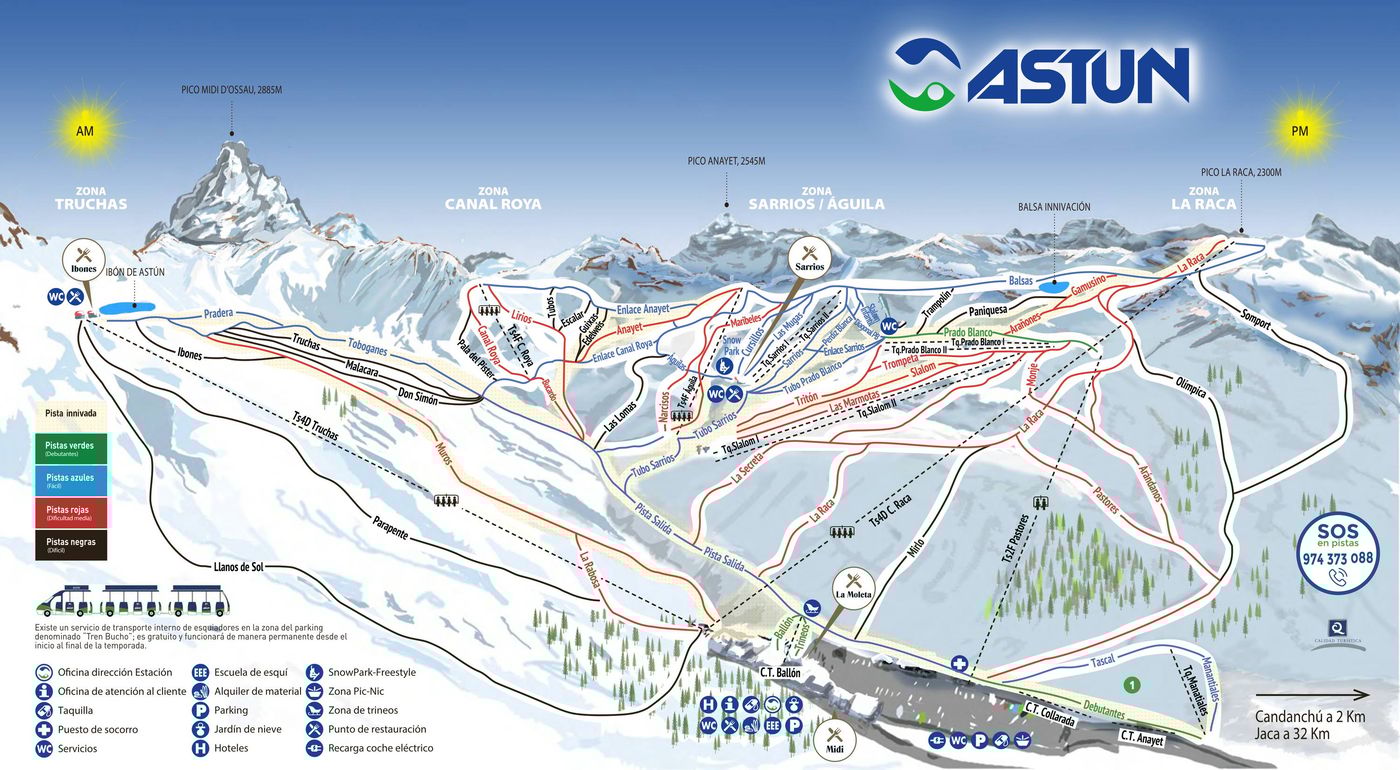
Astún Piste Map
Grab the Astún ski resort map to get a proper look at what this Pyrenean spot has to offer before you head up. The trail map covers 60 runs spread across terrain between 1,700m and 2,300m, with access via 7 chairlifts and 10 drag lifts. Astún operates as a standalone resort, though it's worth noting that neighbouring Candanchú is just down the road if you fancy exploring more of the valley.
Download the Astún Piste Map (PDF & Image)
Best Runs in Astún
-
Sarrios (Green): A wide, gentle slope ideal for complete beginners learning to control their speed and direction.
-
Truca Blanca (Blue): A smooth, confidence-building intermediate run that flows down from the Truchas area with consistent gradient.
-
Escalar (Blue): A well-groomed cruiser offering sweeping turns and excellent carving terrain through the mid-mountain zone.
-
Robellons (Red): A steep, technical descent dropping from the upper slopes with challenging pitch that suits strong intermediates.
-
Tuca Blanca (Red): A demanding red run with varied gradient and width, requiring solid parallel skiing technique throughout.
-
Nariecho (Black): An expert-only mogul field that forms naturally on the steeper sections, testing bump technique and leg stamina.
-
Canal Roya (Black): The resort's most famous off-piste accessible route, a steep couloir requiring avalanche awareness and strong technical ability.
-
Sarrios-Tobazo Connector (Blue): A long, scenic traverse linking different sectors whilst maintaining mellow gradient perfect for exploring the area.