Varingskollen Piste Map
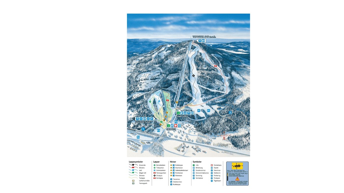
Grab the Varingskollen ski resort map below to help you navigate this compact Norwegian spot before you arrive. The trail map covers 6 runs in total - including 2 beginner runs, 1 intermediate and 2 advanced routes - serviced by 5 drag lifts across a vertical drop of 366m. It's a small setup topping out at 546m, so you'll want to check the map to make the most of what's on offer.
Download the Varingskollen Piste Map (Image)