

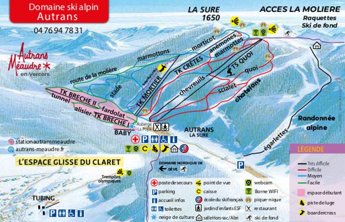
Autrans Piste Map
Grab the Autrans ski resort map above to get familiar with the layout before you arrive. The trail map covers 21 runs split across 7 beginner, 5 intermediate, and 6 advanced pistes, serviced by 1 chairlift and 7 drag lifts between 1050m and 1710m. It's a compact resort that punches above its weight for powder zones and off-piste terrain, making it a solid option if you're after variety without the crowds.
Download the Autrans Piste Map (PDF & Image)
Best Runs in Autrans
Based on Autrans' official piste map, here are the standout runs across the ski area:
-
La Combe (Green): A wide, sheltered beginner run that runs through gentle forest terrain, ideal for building confidence on your first days.
-
Les Niverolle (Green): A long, mellow green that meanders down from the Gève sector with consistent gradient throughout, making it brilliant for practising parallel turns.
-
Le Claret (Blue): A popular intermediate cruise that winds through the trees with enough width to carve proper arcs and test your technique.
-
Les Glovettes (Blue): A tree-lined blue offering consistent pitch and good snow retention thanks to its north-facing aspect.
-
Les Banquettes (Red): Autrans' most challenging red run, featuring steeper sections and a bit more technical terrain that'll keep stronger intermediates engaged.
-
La Serpe (Red): A narrow, twisting red through the forest that demands more precise turn placement and suits those looking to step up their skills.