

Arvieux Piste Map
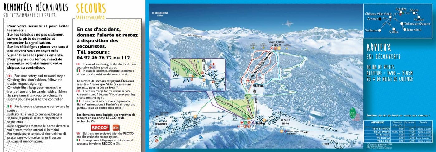
Grab the ski resort map for Arvieux to plan your runs across this compact French gem. The trail map covers 17 runs spread between 1,690m and 2,105m, with eight beginner runs, one intermediate, and seven advanced runs served by one chairlift and four drag lifts. It's a brilliant spot for families and those seeking quieter slopes without the fuss of a mega resort.
Download the Arvieux Piste Map (PDF & Image)
Best Runs in Arvieux
Best Ski Runs at Arvieux
Arvieux is a modest, authentic French resort in the Queyras, offering a limited but well-maintained selection of pistes spread across gentle, sunny slopes. The terrain skews heavily towards beginners and intermediates, with very little on offer for experts seeking serious challenges. Here's what you'll find:
Beginner Runs:
-
Piste des Marmottes (Green): A wide, confidence-building run that meanders gently through open terrain, ideal for those mastering snowplough turns.
-
Piste du Ceillac (Green): This long, flowing green run offers a peaceful descent with minimal gradient changes, perfect for building mileage without stress.
Intermediate Runs:
-
Piste du Fangeas (Blue): A pleasant cruiser that winds through gentle undulations with enough width to practise carving turns at your own pace.
-
Piste de la Clapière (Blue): This well-groomed blue offers a bit more pitch than the greens, making it a logical next step for progressing skiers.
-
Piste de l'Izoard (Red): Arvieux's main red run provides a slightly steeper gradient and narrower sections, offering a mild technical step-up for confident intermediates.
-
Piste du Grand Queyras (Red): A longer red with varied terrain that's ideal for practising speed control and linking smoother turns on exposed mountainside.
Expert Runs:
- Piste de la Bergerie (Red/Black depending on source): The resort's most challenging marked run, featuring a steeper pitch and tighter turns, though it's still fairly tame by serious skier standards.
Arvieux isn't a destination for adrenaline-seeking experts—the off-piste touring potential in the surrounding Queyras region is where the real interest lies for advanced riders. For beginners and cautious intermediates, though, it's a relaxed, unpressured environment to build skills.