



Ylläs Piste Map
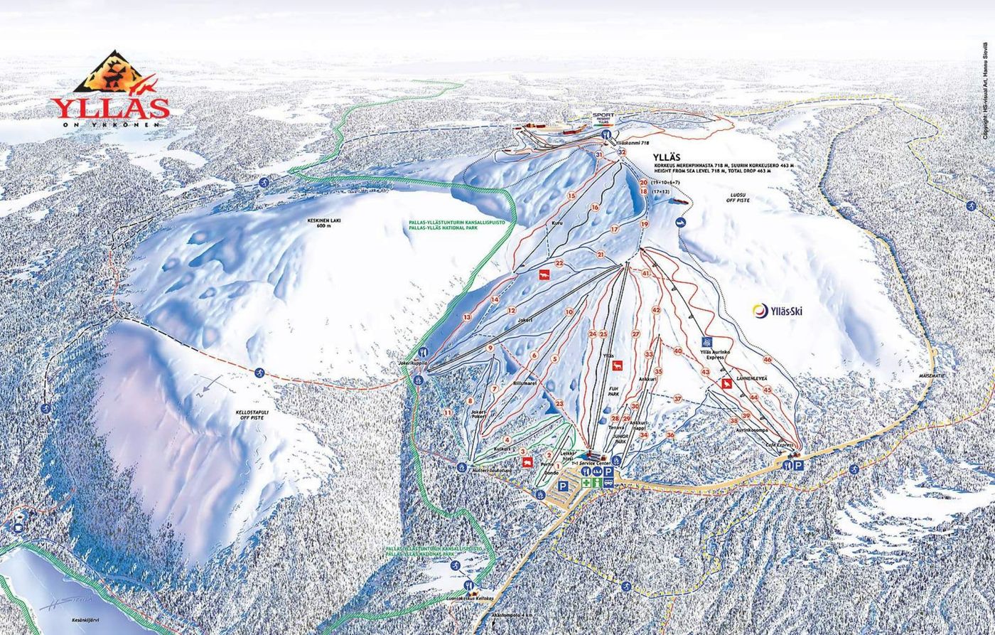
Grab the Ylläs ski resort map to get your bearings before you head out - it's a great tool for planning your days on the hill. The trail map covers 63 runs spread across a vertical drop from 718m down to 255m, serviced by one gondola, one chairlift, and 23 drag lifts. It's Finland's largest ski area and genuinely beginner-friendly, though the stats show it caters well to intermediates and advanced skiers too.
Download the Ylläs Piste Map (PDF & Image)
Best Runs in Ylläs
-
Rouhe (Green): A wide, gentle slope ideal for complete beginners getting to grips with their first turns.
-
Pöllintie (Blue): A mellow, tree-lined cruise that winds through the forest, offering scenic views and consistent pitch for building confidence.
-
Kukastie (Blue): A long, flowing run that lets intermediate skiers open up their turns and enjoy smooth carving on well-groomed pistes.
-
Rinnepäällystie (Blue): A popular intermediate trail with varied terrain that's perfect for practicing technique without too much pressure.
-
Jäniskuru (Red): A challenging red run with steeper sections and tighter turns through the trees, testing your edge control.
-
Kelohonka (Red): A technical descent with a consistent pitch that rewards confident intermediates looking to push their skiing.
-
Länsi-Lapio (Red): A steep, direct line down the front face that offers proper leg-burn and excellent carving opportunities when freshly groomed.
-
Iso-Ylläksen Rinne (Black): The resort's most demanding pisted run, featuring sustained steepness and moguls that'll challenge even experienced skiers.