

Dreiländereck Piste Map
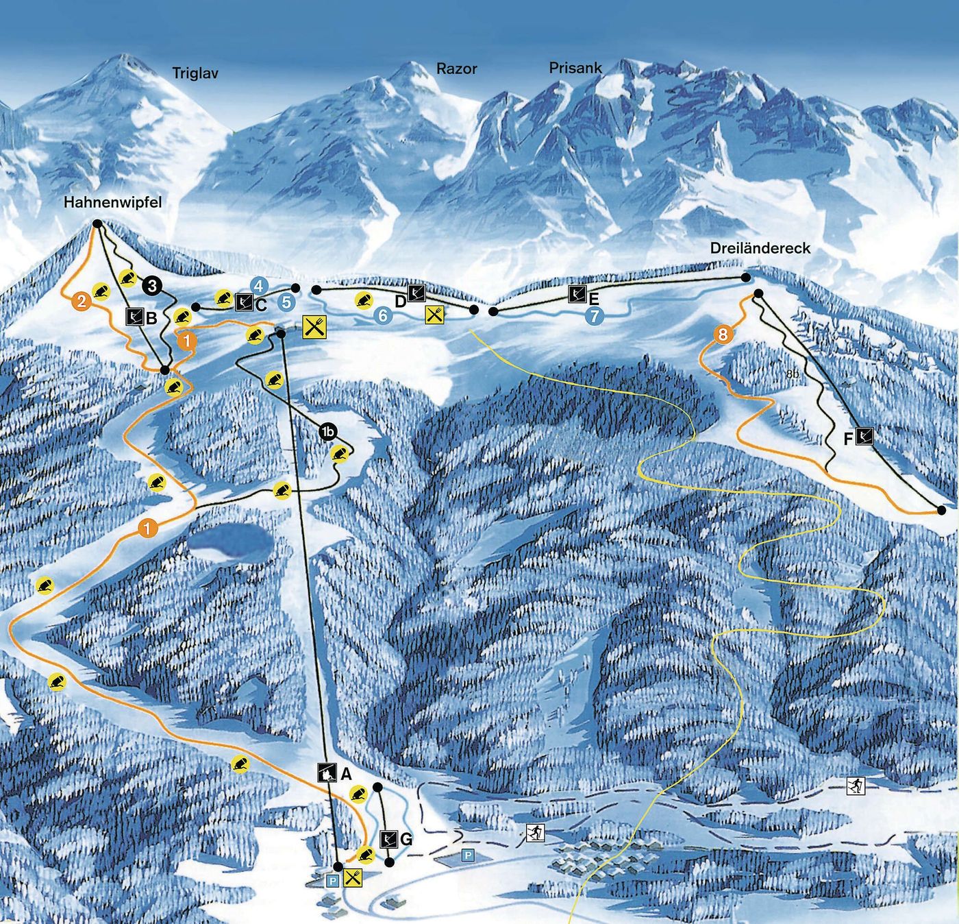
Grab the Dreiländereck ski resort map to get your bearings before you head out on the mountain. The trail map covers 12 runs spanning from 1600m down to 680m, including six beginner-friendly pistes, three intermediate runs, and three advanced options. You'll find one chairlift and seven drag lifts servicing the slopes.
Download the Dreiländereck Piste Map (Image)
Best Runs in Dreiländereck
Looking at the official piste map and resort info, Dreiländereck (also known as Arnoldstein) is a small Austrian ski area near the borders with Italy and Slovenia. It's worth noting this is quite a compact resort, so the selection of runs is limited compared to major Alpine destinations.
-
Familienabfahrt (Blue): A mellow cruiser that's ideal for families and early intermediates building confidence over consistent, forgiving terrain.
-
Sonnenhang (Blue): A wide, south-facing piste that picks up excellent morning sun and offers relaxed cruising with plenty of space to link turns.
-
Standardabfahrt (Red): The main descent from the top station, offering a decent vertical drop with a mix of moderate pitches that suit confident intermediates.
-
Buckelpiste (Red): A mogul run that provides a proper technical workout when left ungroomed, perfect for intermediates wanting to sharpen their bump skills.
-
Talabfahrt (Red): The valley run back to base that covers good distance and keeps things interesting with varied gradient changes throughout the descent.