

Ankogel Piste Map
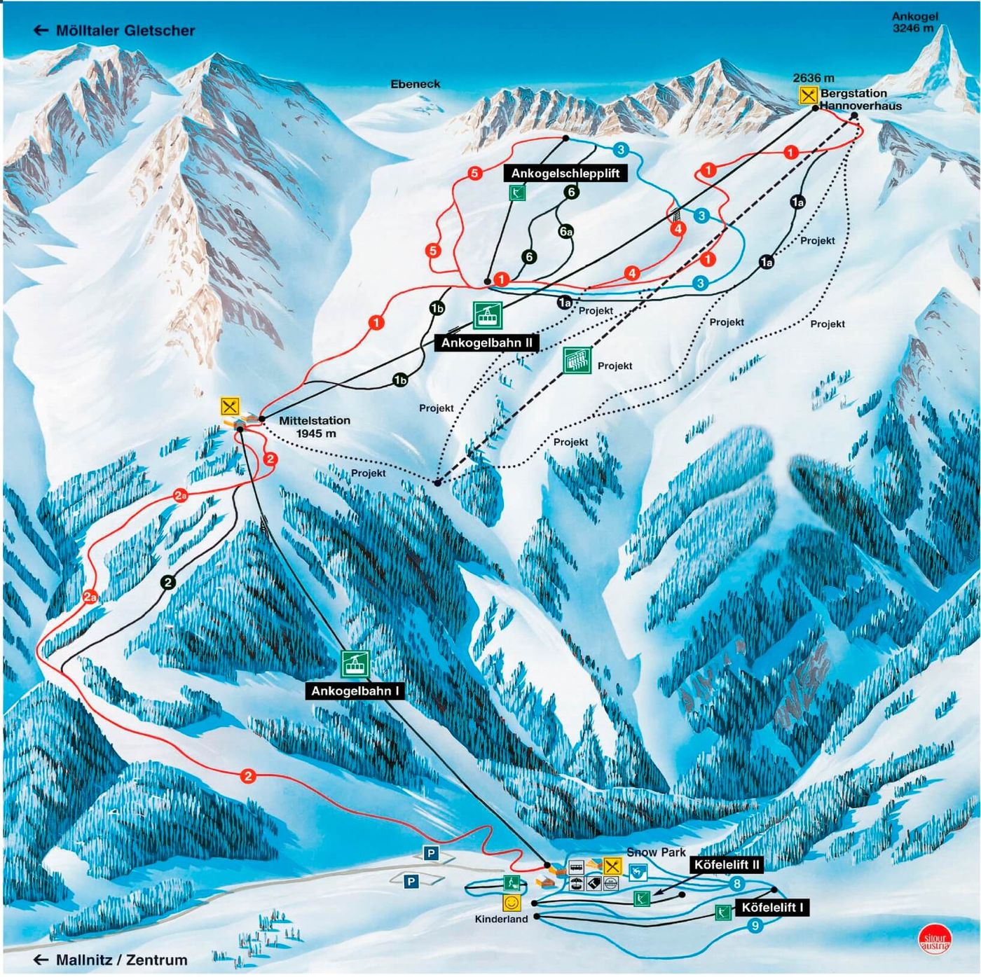
Grab the Ankogel ski resort map to get a proper look at what's on offer before you hit the slopes. The trail map covers 13 runs spread across 1,436m of vertical drop, from 1,200m up to 2,636m, with a fairly even mix of terrain: 3 beginner runs, 5 intermediate runs, and 5 advanced runs. You'll find 2 gondolas and 3 drag lifts servicing the area, making it a compact but worthwhile spot for skiers looking to escape the crowds.
Download the Ankogel Piste Map (PDF & Image)
Best Runs in Ankogel
-
Piste 1 (Blue): A wide, cruising run that stretches from the top of the Hannoverhaus lift down to the mid-station, ideal for building confidence on smooth, rolling terrain.
-
Piste 2 (Red): This challenging red begins at the glacier and offers consistent steep sections with open carving opportunities across the upper mountain.
-
Piste 3 (Blue): A mellow blue that winds through the mid-mountain area, providing scenic views across the Ankogel massif with forgiving gradients throughout.
-
Piste 4 (Red): A technical red run that demands good edge control as it navigates tighter sections and variable pitch on the descent towards Mallnitz.
-
Piste 5 (Black): The resort's most demanding groomed run, featuring sustained steep pitches and narrow sections that'll test your technique from top to bottom.
-
Übungslift Area (Green/Blue): A dedicated beginner zone near the base with gentle, wide slopes perfect for first-timers getting to grips with turns and speed control.